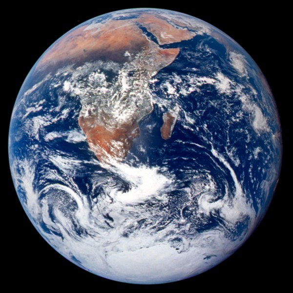
It’s been called one of the most famous and widely distributed images in human history. The “blue marble,” a 1972 color photograph of the Earth from the Apollo 17 spacecraft, has also been credited with expanding environmental awareness around the globe and highlighting the vulnerability of our home planet.
In the four decades since the blue marble was captured on film, other astronauts and unmanned spacecraft have trained their lenses on the Earth, sometimes while in orbit, other times while racing toward another celestial body. I stumbled upon some of these images while surfing the Web recently and have collected my favorites in a PowerPoint deck that you download at the bottom of this post.
I find these images captivating, even mesmerizing. They’re also useful in creating presentations. NASA’s next generation of blue marble images can be downloaded as very high-resolution files that allow you to zoom in on an area of interest (see our earlier post to learn about similar, high-res images of the Earth’s vegetation).
We often take the 30,000-foot view here at EcoWest, trying to understand mega-trends in the American West, but occasionally it’s worth stepping back even farther, to many millions of miles away, so we can see the truly big picture. Below I describe 10 of the views, including some animations, that I found most striking (click on images to enlarge).
1) The original blue marble
The iconic blue marble photo was taken on December 7, 1972 as the Apollo 17 spacecraft departed Earth for the moon. The image was snapped 5 hours after liftoff and 2 hours after the spacecraft left its parking orbit around Earth. The spacecraft was already 28,000 miles away from the planet and situated perfectly for the shot–with the sun behind the camera, the full disc of Earth was visible.

2) Earlier color image of full Earth
The blue marble wasn’t the first time the full Earth had been photographed in color. The image below, captured by the ATS-3 communications satellite in 1967, was on the cover of the Whole Earth Catalog in fall 1968.

3) Next generation blue marble
NASA’s next generation of blue marble imagery takes advantage of a variety of satellites and stitches together many months of observations to provide a clear view of Earth. Much of the data came from the MODIS device on the Terra and Aqua satellites. Below is the view of the Western hemisphere.

Reflecting on the blue marble images, Donald Wuebbles, an atmospheric scientist at the University of Illinois at Urbana-Champaign, described them this way:
The abundance of water on our planet visible in the “Blue Marble” photo clearly separates us from all others in the solar system. The flows and interactions of clouds as part of our weather also appear prominently in the photo. The interconnectedness of all the spheres—hydrosphere, atmosphere, cryosphere, and lithosphere—into one sphere is the power of this image and of later images of the Earthtaken from unmanned spacecraft.
It’s been an epoch since I took Earth science, so I confess to looking up cryosphere (ice caps, glaciers, etc.) and lithosphere (crust and mantle).
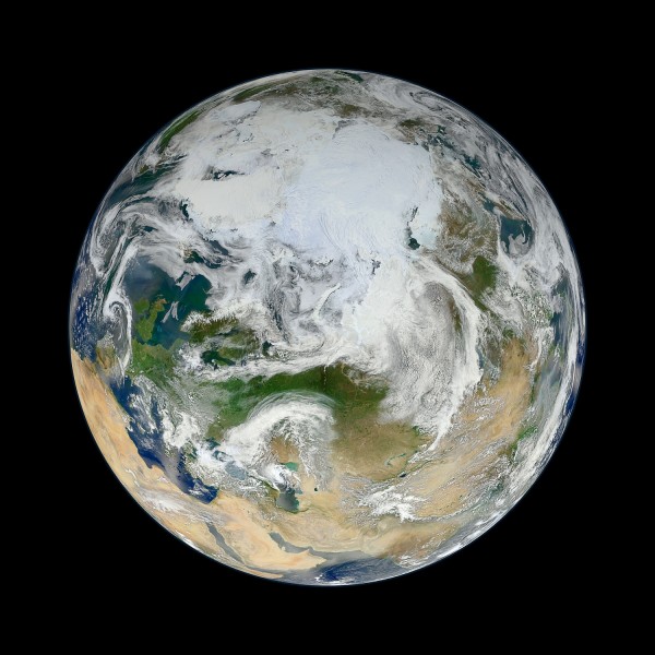
4) Looking down on the arctic
At first glance, you may not recognize the planet depicted below. That’s because you’re looking down on Earth from over Siberia, rather than from the typical equatorial vantage point. In this view of the Arctic, based on 15 passes by the Suomi-NPP satellite on May 26, 2012, you can get a sense of why melting the Greenland Ice Sheet would lead to a cataclysmic rise of sea levels by some 24 feet.

5) Night lights and the black marble
The dark side of the Earth has plenty of lights, as shown in the image below from April and May 2012. NASA’s city lights series provides a powerful summary of development patterns across the globe. The PowerPoint deck includes some close-ups of the United States, but even in this hemispheric view you can see how the country’s population is concentrated in the eastern half and along the West Coast.

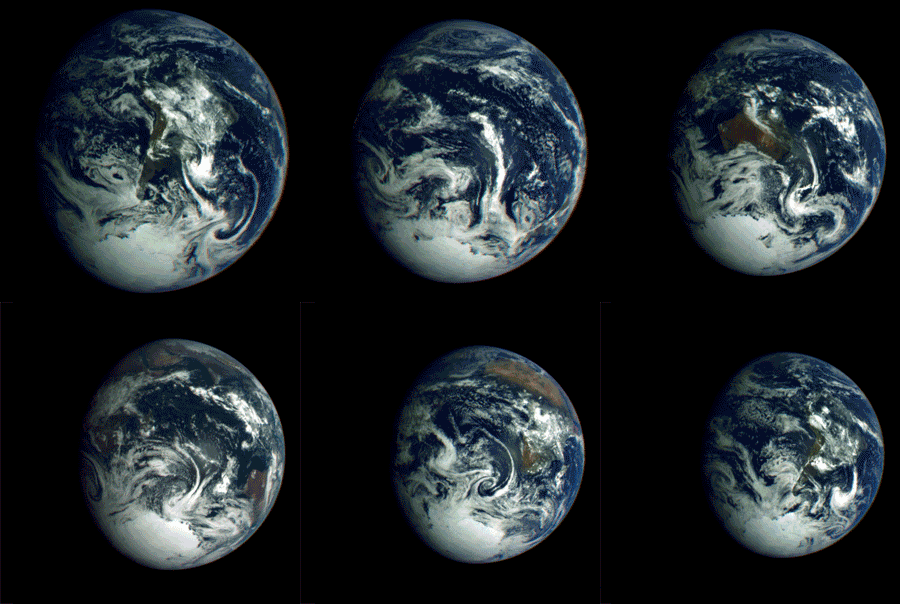
6) Animation of Earth’s rotation
As the Galileo spacecraft departed Earth in 1990 for its exploration of Jupiter, it looked back and captured this sequence of images over a 25-hour period.

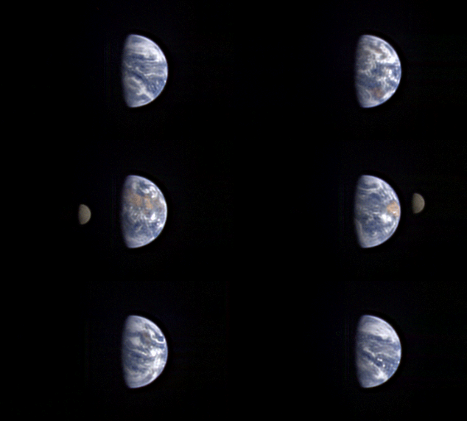
7) Lunar transit of Earth
The Deep Impact spacecraft, launched in 2005 to study comets, sent back stunning images of the moon transiting the Earth. This animation shows a lunar transit in 2008 from 31 million miles away.

8) Solar eclipse viewed from lunar orbiter
The Lunar Reconnaissance Orbiter, launched in 2009, captured the May 12, 2012 solar eclipse in the image below, which shows the shadow over the Aleutian Islands.

9) Time-lapse from the International Space Station
OK, so this one’s a little different, but I would urge you to check out the video embedded below, which shows what the Earth looks like to the crew of the International Space Station. There are some spectacular views of the night lights, aurora borealis/australis, and lightning flickering in thunderstorms. The video is a time-lapse compilation of photographs taken by the crew of the space station, which orbits about 260 miles above Earth at 17,200 mph.
Earth from Michael König on Vimeo.
10) The earth and moon from Saturn
Finally, to put things in perspective, there’s this recent view of the Earth from the Cassini spacecraft orbiting Saturn. From 898 million miles away, our planet is just a dot.
More images coming
In the years ahead, I’m sure we’ll be treated to even more stunning images of planet Earth. The Deep Space Climate Observatory, originally proposed by former Vice Preident Al Gore and possibly inspired by the original blue marble photo, is scheduled to be launched in 2015 by the SpaceX company. The observatory, which became a political football, will be situated about 1 million miles from the planet, at a point where the gravitational pull of the Earth and Sun cancel. From there it will warn of potentially harmful solar activity, and have a continuous view of the sunlit side of Earth.
Data sources
The best source I found for whole Earth images is this page on the Planetary Society’s website.
NASA’s blue marble images are found on this page and described further here.
Downloads
EcoWest’s mission is to analyze, visualize, and share data on environmental trends in the North American West. Please subscribe to our RSS feed, opt-in for email updates, follow us on Twitter, or like us on Facebook.

